
Key Features
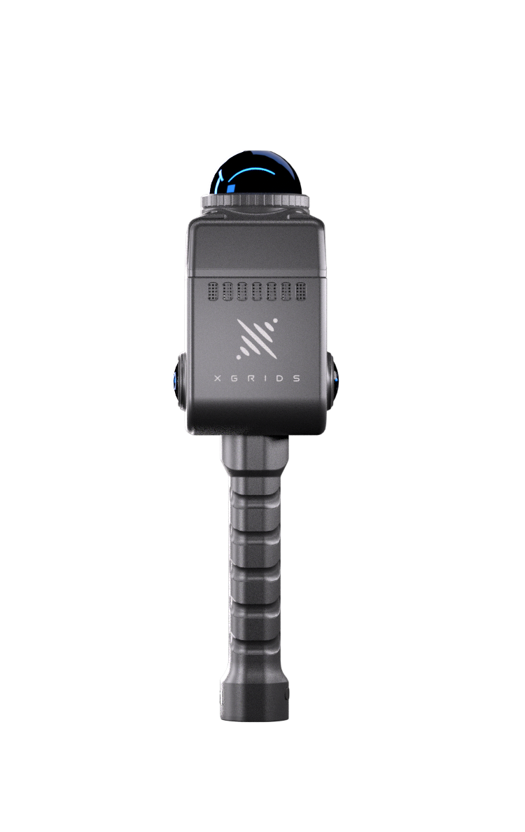
Ultra-portable design – weighing just around 1 kg including battery, it’s easy to hand-carry or mount on robotics rigs.
High-fidelity data capture – features a 360° horizontal field of view LiDAR (approx. 40 m range, 200,000 points/sec) and dual high-resolution panoramic cameras for real-time colour point clouds.
Real-colour, true-vision capture – produces full-360° × 360° panoramic imagery and colourised point clouds ready for immediate use.
Robust build and workflow ready – IP54-rated enclosure, 90-minute runtime, external TF card storage, and Wi-Fi/Bluetooth connectivity for mobile device control.
Included software suite – includes Lixel Studio for point cloud processing and Lixel Go mobile app for field control and monitoring.
Applications & Use-Cases
The Lixel K1 supports a wide range of professional applications:
Digital-twin creation & BIM – ideal for capturing building interiors, infrastructure, and industrial assets.
XR, VR, film & gaming – delivers photorealistic data for immersive digital environments and virtual production.
Robotics & AI – supports SLAM-based mapping, real-time environment understanding, and 3D model generation for autonomous systems.
Surveying & geospatial mapping – excellent for small-to-medium sites where mobility and setup speed matter.
Cultural heritage & architecture – efficient for scanning structures and artefacts for documentation and preservation.
How It Supports Robotics & AI Workflows
The Lixel K1’s compact, real-time 3D scanning capability makes it ideal for robotics and AI integration:
Real-time coloured point clouds for robotic mapping, object recognition, and environment understanding.
Lightweight design enables easy mounting on ground robots, drones, or inspection vehicles.
360° scanning with SLAM compatibility supports autonomous navigation and dynamic mapping.
Rich colour and texture data improve AI training datasets and support semantic segmentation and object classification.
Fast capture-to-model workflow streamlines the loop between real-world data collection and AI model training.


Considerations
Range limitation – with an effective LiDAR range of around 40 m, the K1 is not designed for large-scale terrain mapping.
Point-density trade-off – its 200,000 points/sec rate suits most applications but falls below top-tier scanners like the Lixel L2 Pro.
Workflow demands – large colourised datasets require capable hardware and thoughtful data management.
Environment limits – not suited for extreme conditions such as heavy dust, fog, or very large outdoor sites.
Training requirements – optimal results require familiarity with SLAM, point-cloud workflows, and data integration pipelines.
Why Choose This Package
Outstanding portability and precision – professional-grade results in a compact handheld form.
Fast deployment – ideal for teams needing to capture and process spatial data on the move.
AI and robotics-ready – built to integrate directly into digital-twin, SLAM, or vision-based AI environments.
Future-proof technology – bridges the gap between high-end surveying and next-generation automation.
Perfect for R&D and education – accessible tool for universities, robotics labs, and innovation teams exploring spatial computing.
Recommendation
For organisations, researchers, and service providers building AI or robotic systems that rely on accurate 3D spatial awareness, the XGRIDS Lixel K1 Standard Package offers a practical, cost-effective solution. It combines portability, precision, and visual realism in one compact unit, ideal for robotics mapping, digital-twin creation, or real-world dataset capture.
Technical Specifications
Weight: approx. 1 kg (including battery)
LiDAR: 40 channels, ~40 m range, 200,000 points/sec
Accuracy: Relative ±1.2 cm; Absolute ≤ 3 cm
Cameras: Dual 48 MP panoramic sensors
Runtime: approx. 90 minutes
Protection: IP54
Storage: 256 GB TF card (replaceable)